|
Index
Index
The153 Club
The Agades Cross
People of the Sahara
Saharan Landscapes
Saharan Salt Trade
The Gundi
Illizi Festival 2000
Sahara Freeze-up
Camel Cheese
153 News Update
Join the 153 Club
Père de Foucauld
L'Arbre du Ténéré
1
L'Arbre du Ténéré 2
Saharan Forts 1
Saharan Forts 2
Saharan Rock Art
Giraffe Engravings
Leo Africanus
Battuta's Saharan travels
Shabeni's Timbuktu
Timbuctoo the Mysterious
Heroditus & Pliny on Libya
Timbuktu, a poem
Joliba Trust
Ibn Khaldûn quotes 1
Ibn Khaldûn quotes 2
Ibn Khaldûn quotes 3
Ibn Khaldûn quotes 4
Ibn Khaldûn quotes 5
Ibn Khaldûn quotes 6
Old Michelin Maps
Early NW Africa Map 1
Early NW Africa Map 2
Early NW Africa Map 3
Early NW Africa Map 4
Early NW Africa Map 5
Saharan Exploration
Henry Barth 1
Henry Barth 2
Henry Barth 3
Denham & Clapperton 1
Denham & Clapperton 2
Haardt & Audouin-Dubreuil 1
Haardt & Audouin-Dubreuil 2
Haardt & Audouin-Dubreuil 3
Haardt & Audouin-Dubreuil 4
External Links
Jim
Mann Taylor's Home Page
___________________________
|
The Catalan map of the Sahara
in 1375
| The 1375
Catalan map (part of the Mapamundi) was drawn by Abraham Crepques
of Mallorca and has a section dealing with NW Africa which is
reproduced below. It shows the King Mansa Musa of Mali (holding
a large nugget of gold) trading with the nomad on the left. The
Atlas mountains are clearly visible. |
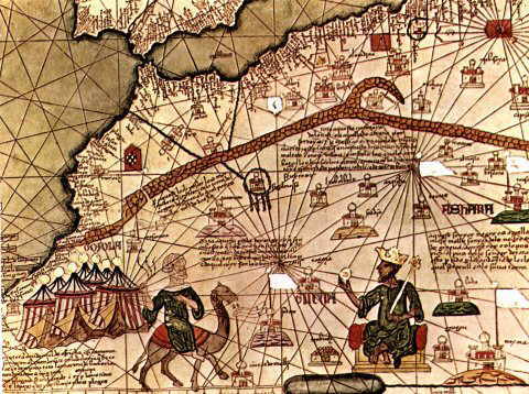
The
section to the right translates as: This
Negro lord is called Musa Mali, Lord of the Negroes of Guinea.
So abundant is the gold which is found in his country that he
is the richest and most noble king in all the land.
The section top left translates as:
Through this place pass the merchants who travel
to the land of the negroes of Guinea, which place they call the
valley of the Dra'a.
The section middle left translates as
All this region is occupied by people who veil their mouths; one
only sees their eyes. They live in tents and have caravans of
camels. There are also beasts called Lemp from the skins of which
they make fine shields.
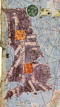
Out of interest I append below the map of
Scotland, England and Wales from the same Atlas made in 1375.
|
Have you yourself travelled in North West Africa?
Then you should be interested in joining us. Join.
We have been going since 1978.

|